use cases
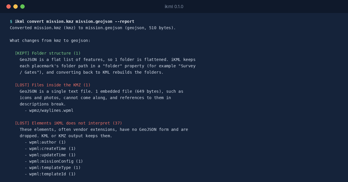
A DJI Drone Mission KMZ and What a GIS Import Would Drop
Drone mapping and inspection work runs on mission files. DJI’s planning software saves a mission as a KMZ that holds a folder called wpmz, with a template.kml …
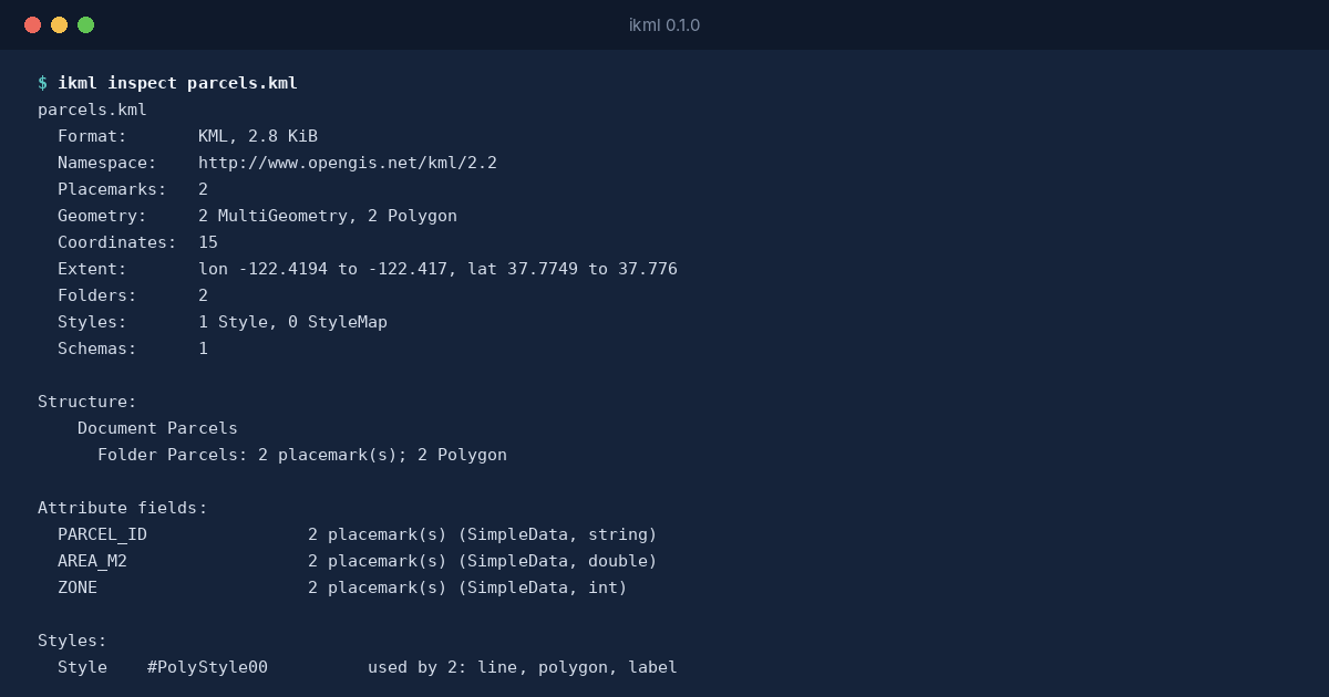
iKML opens KML, KMZ and GeoJSON files and tells you what's inside, what's broken and what a conversion will lose. Then it writes a cleaned copy. It runs in your browser with nothing uploaded, or as one small program.
22 of 22
Broken test files flagged with exactly the issue codes they were made to trigger
0 bytes
Of your file sent anywhere by the in-browser inspector
1 engine
The same Go code in the ikml program and the browser, standard library only
Apache 2.0
License for all of the code
Counts from iKML's recorded test run. The test logs are on GitHub.
use cases
Drone mapping and inspection work runs on mission files. DJI’s planning software saves a mission as a KMZ that holds a folder called wpmz, with a template.kml …
use cases
Some geographic files shouldn’t leave the building. A utility’s network map, the plot boundaries of a development that hasn’t been announced, the survey …
use cases
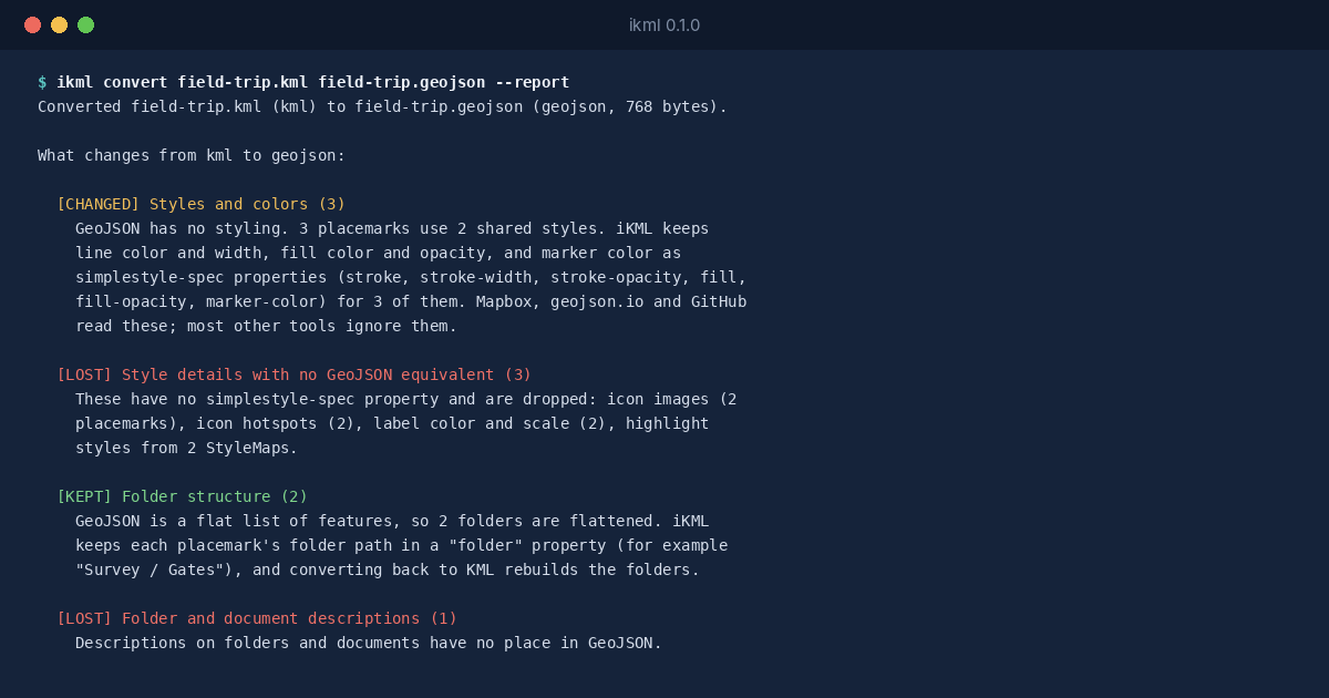
Google My Maps is where a lot of maps start: a school trip, a list of venues, a delivery route, built by someone who never opened a GIS. When the map needs to go …
use cases
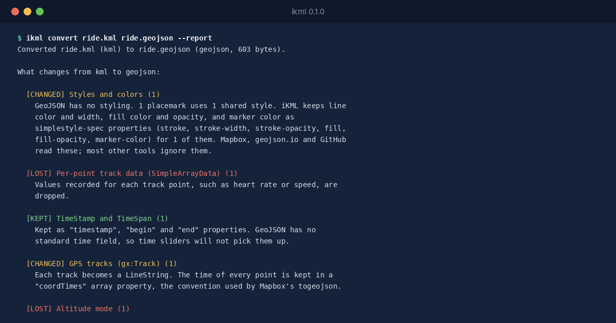
A GPS track in KML is more than a line. Google’s gx:Track element stores a time for every position, so a ride, a run or a vehicle’s day can be replayed, …
testing
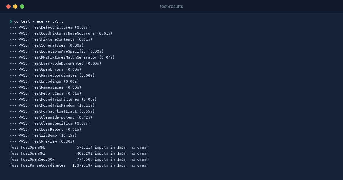
iKML makes two kinds of promise. When it reads a map file, it should report what’s really wrong with it, in a place you can find. When it writes a file, the shapes …
releases
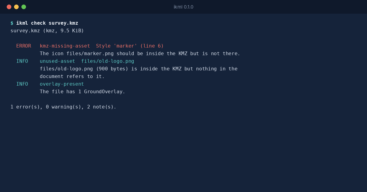
Somebody sends you a map file. A KMZ from a drone pilot, a KML export from Google My Maps, a GeoJSON layer from a city’s open data portal. You open it in QGIS, or …
use cases
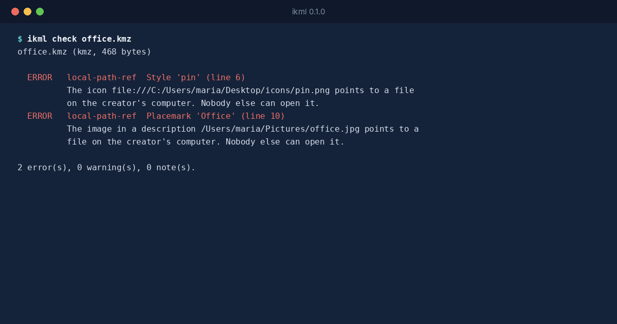
A KMZ is supposed to carry its pictures with it. That’s the reason it exists: the KML document goes into a zip archive together with the icons, the photos in the …
use cases
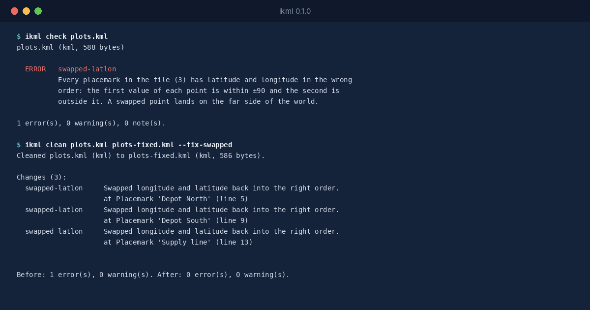
KML writes every position as longitude first, then latitude: 34.78,32.08 is a point in Tel Aviv. Most people say coordinates the other way round, “latitude, …
use cases
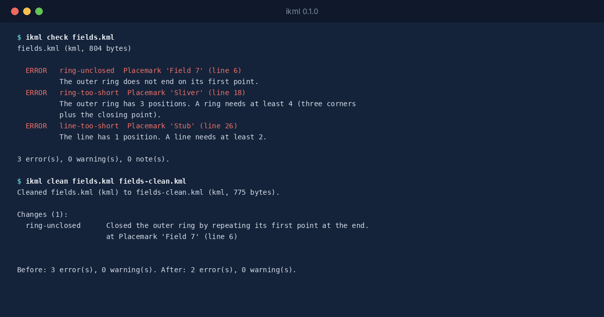
A polygon in KML and GeoJSON is a ring of positions that ends where it starts. The last position must repeat the first, exactly. It looks redundant, and that’s …
If iKML nearly fits the files you work with, or you'd like it to read a format it doesn't yet, write in.