use cases
A DJI Drone Mission KMZ and What a GIS Import Would Drop
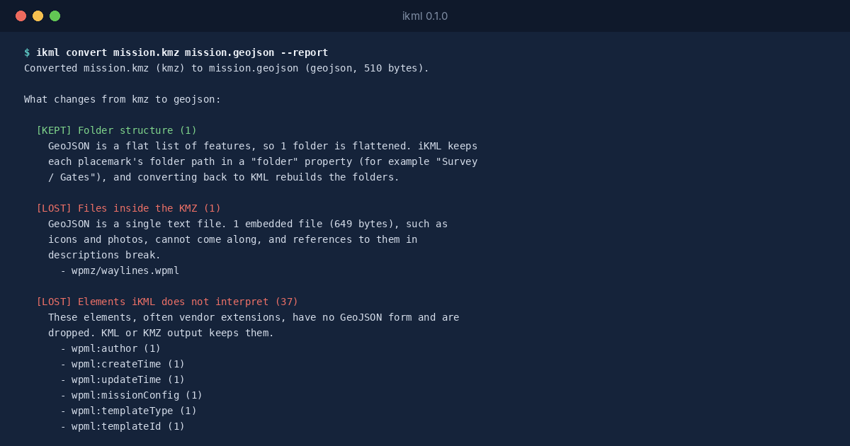
Drone mapping and inspection work runs on mission files. DJI’s planning software saves a mission as a KMZ that holds a folder called wpmz, with a template.kml …
use cases
Drone mapping and inspection work runs on mission files. DJI’s planning software saves a mission as a KMZ that holds a folder called wpmz, with a template.kml …
use cases
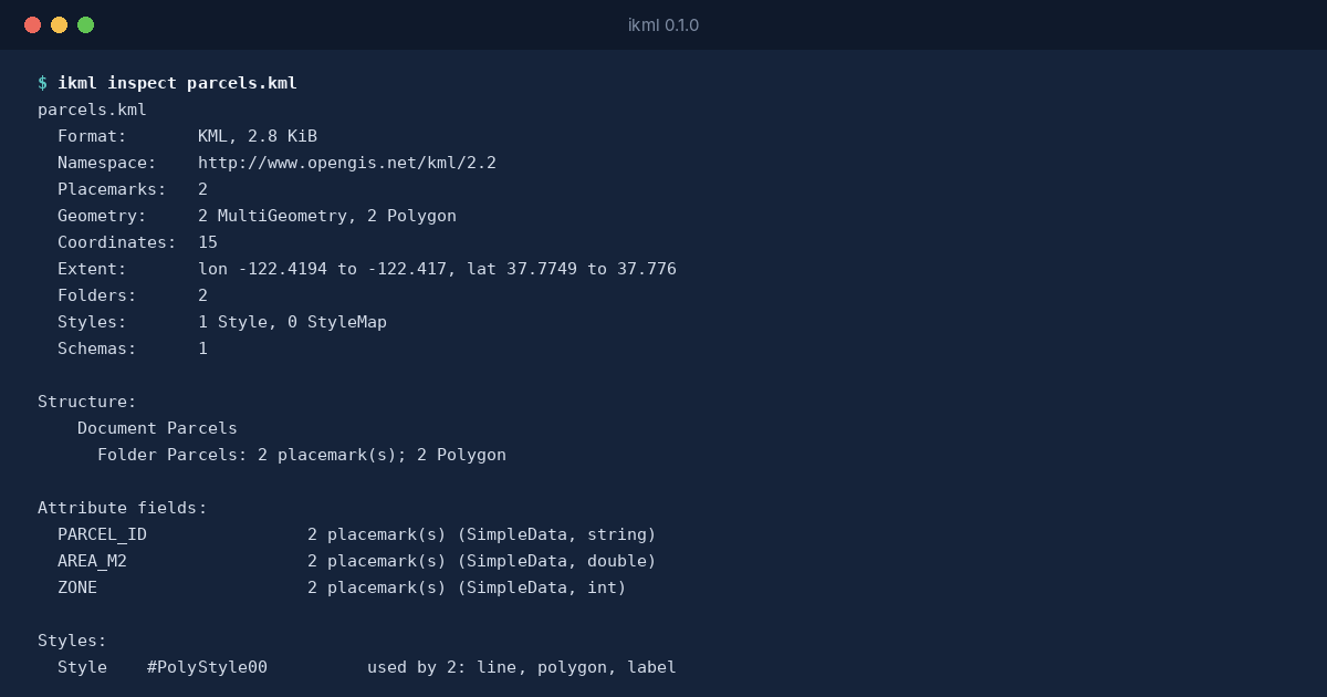
Some geographic files shouldn’t leave the building. A utility’s network map, the plot boundaries of a development that hasn’t been announced, the survey …
use cases
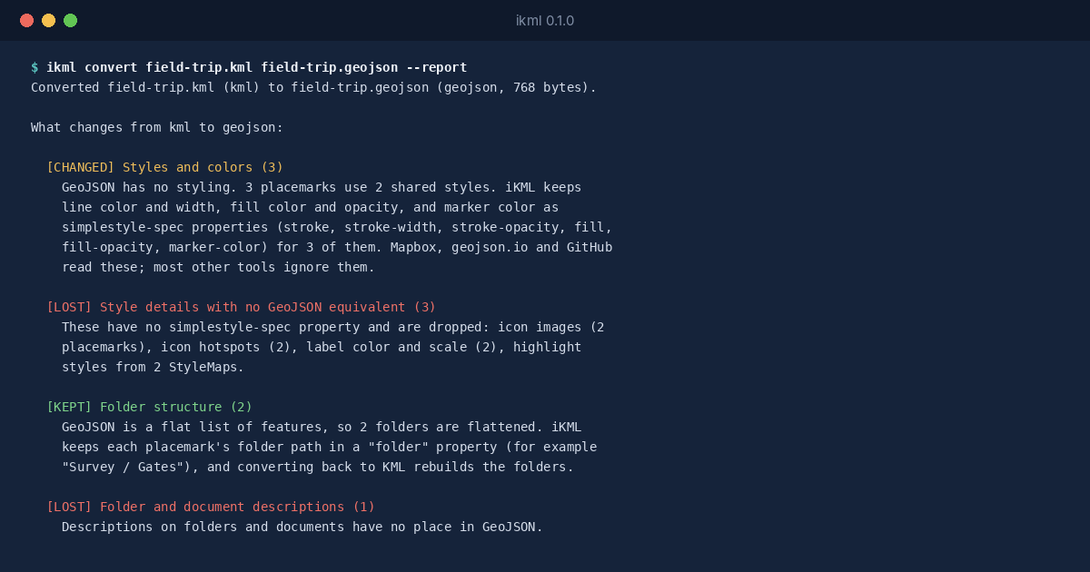
Google My Maps is where a lot of maps start: a school trip, a list of venues, a delivery route, built by someone who never opened a GIS. When the map needs to go …
use cases
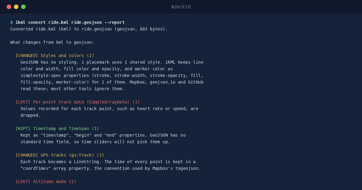
A GPS track in KML is more than a line. Google’s gx:Track element stores a time for every position, so a ride, a run or a vehicle’s day can be replayed, …
testing
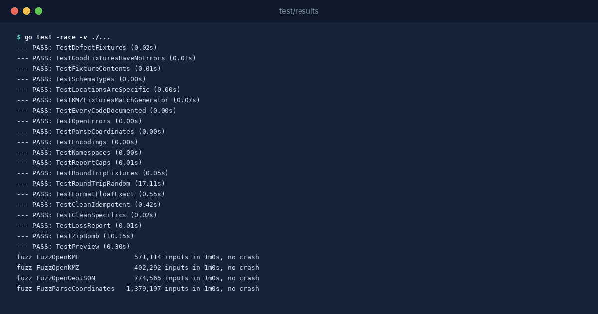
iKML makes two kinds of promise. When it reads a map file, it should report what’s really wrong with it, in a place you can find. When it writes a file, the shapes …
releases
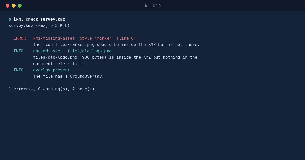
Somebody sends you a map file. A KMZ from a drone pilot, a KML export from Google My Maps, a GeoJSON layer from a city’s open data portal. You open it in QGIS, or …
use cases
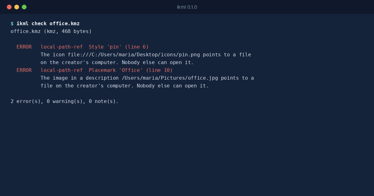
A KMZ is supposed to carry its pictures with it. That’s the reason it exists: the KML document goes into a zip archive together with the icons, the photos in the …
use cases
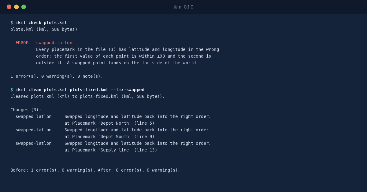
KML writes every position as longitude first, then latitude: 34.78,32.08 is a point in Tel Aviv. Most people say coordinates the other way round, “latitude, …
use cases
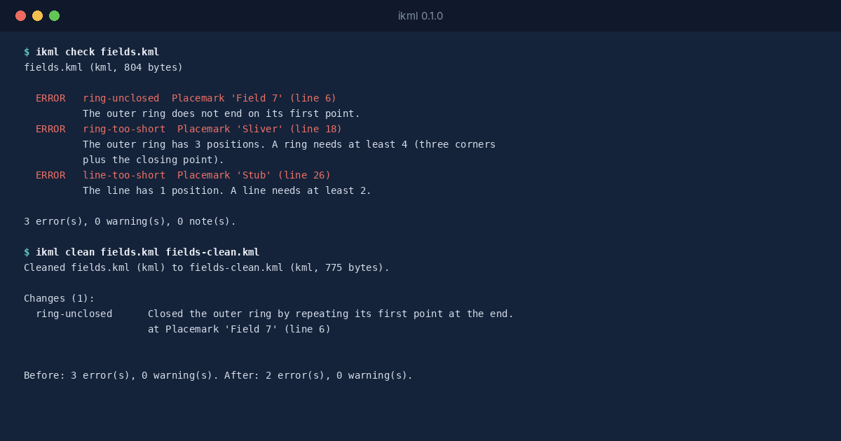
A polygon in KML and GeoJSON is a ring of positions that ends where it starts. The last position must repeat the first, exactly. It looks redundant, and that’s …
explainers
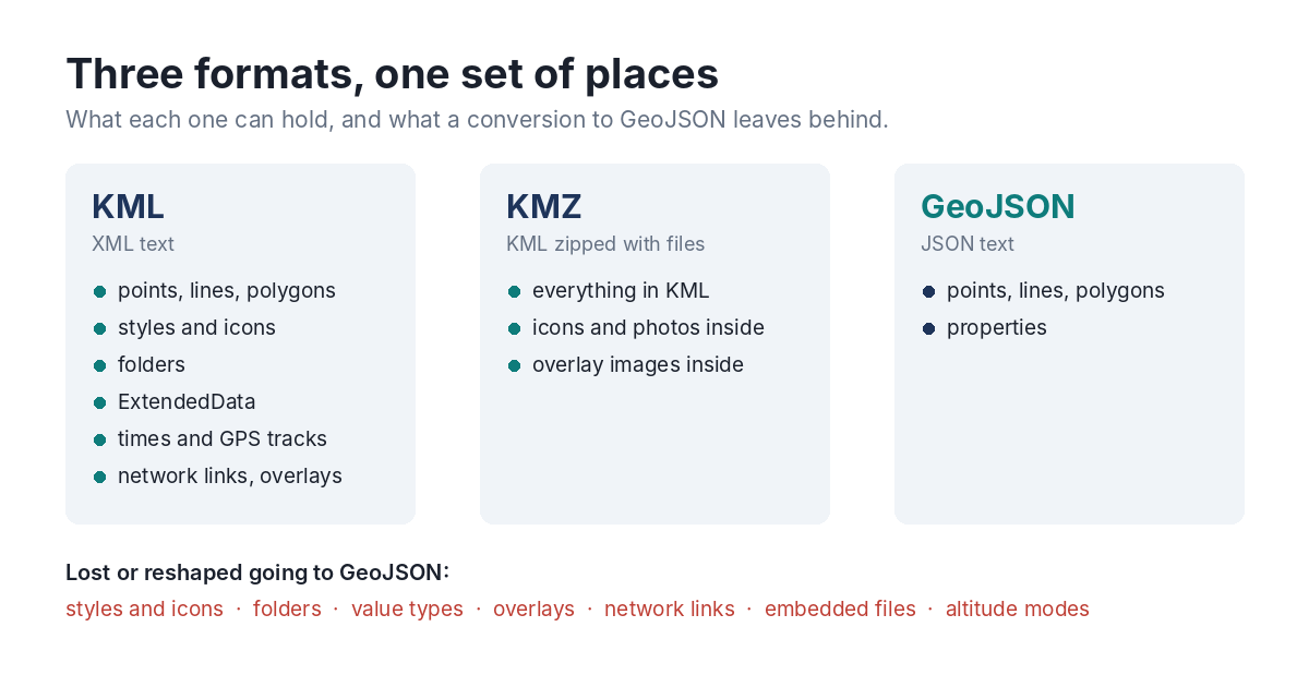
Most map data that moves between people moves in one of three formats. They look interchangeable, and every tool converts between them. They aren’t interchangeable, …